Drone Services
Drone Services
Drone services for Aerial Photography & Videography, Photogrammetry,
Surveying and Mapping, agricultural Monitoring and Infrastructure and Industrial Inspection
Drone Technology
Discover the benefits of our Drone services and what we have to offer
From preflight planning to flying and inspection we have you covered.
We specialize in aerial Photography & Videography, Photogrammetry, Surveying & Mapping, Agricultural Monitoring and Infrastructure and Industrial Inspection
Drone Services
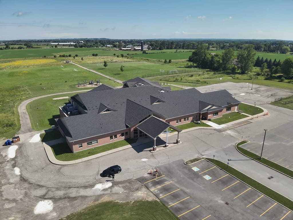
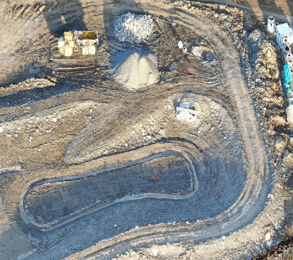
High-resolution drone footage allows us to visually inspect critical infrastructure, monitor assets, and provide digital documentation. We can also provide real-time aerial views that support progress tracking, site planning and safety assessments. Our photogrammetry capabilities enable us to capture accurate topographic and terrain data.
We also have infrared and thermal capabilities
Our drone applications
AEC
Pipeline Inspection
Corridor Inspection
Railway Inspection
Asset Management
Site Security
Wind Turbine Inspection
Infrastructure Inspection
Agricultural monitoring
Site Security
Questions?
We've got answers!
Drone Services
Aerial Photography
Professional aerial photography services that deliver high-resolution, drone-captured imagery for inspections, surveying, and visual documentation across various industries
Aerial Videography
High-quality aerial videography services using advanced drones to capture dynamic, high-resolution footage for inspections, construction monitoring, and promotional content.
Photogrammetry
Advanced photogrammetry services that transform high-resolution aerial imagery into accurate 3D models and maps for surveying, construction, and engineering applications.
Inspection
Precise aerial inspection services using drone technology to safely and efficiently assess infrastructure, construction sites, and industrial assets from above.
Surveying and Mapping
Surveying and mapping services that combine drone technology with photogrammetry and LiDAR to deliver accurate, high-resolution topographic data for engineering, construction, and land development projects.
Agricultural Monitoring
Aerial monitoring services that leverage drone technology to provide real-time, high-resolution oversight of sites, assets, and environments for improved operational awareness and decision-making.
Let's get started!
Call or email our team for an estimate.