Imagine needing precise measurements of a building facade, a winding road, or even an entire crime scene. Traditional methods like tape measures and land surveying can be time-consuming, labor-intensive, and even dangerous in some situations. This is where LiDAR scanning comes in!
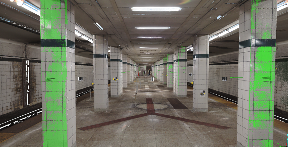
LiDAR stands for Light Detection and Ranging. It’s a technology that uses pulsed laser light to measure the distance to a target. By rapidly firing millions of laser pulses per second and recording the return time, LiDAR scanners can create incredibly detailed 3D point clouds of an environment.
What Makes LiDAR Scanning Unique?
Unlike traditional 3D scanning methods that rely on cameras and projected light, LiDAR works well in various lighting conditions. This makes it perfect for capturing data in dark or low-light environments, even outdoors at night. Additionally, LiDAR excels at penetrating through light vegetation, making it valuable for surveying forested areas or overgrown terrain.
LiDAR Scanning for Engineering: A Powerful Tool
For engineers, LiDAR scanning offers a wealth of benefits:
- Highly Accurate Measurements: LiDAR data provides incredibly precise measurements, perfect for tasks like calculating volumes, analyzing clearances, and creating detailed as-built models.
- Improved Efficiency: Compared to traditional methods, LiDAR scanning can capture vast amounts of data quickly and efficiently, saving time and resources on projects.
- Enhanced Safety: LiDAR allows for capturing data in hazardous or hard-to-reach areas, minimizing risk for personnel.
- Detailed 3D Models: The point cloud data generated by LiDAR can be used to create highly accurate 3D models of buildings, infrastructure, and landscapes. These models are invaluable for design, planning, and construction projects.
Beyond Engineering: LiDAR’s Diverse Applications
While engineering is a major user of LiDAR technology, its applications extend far beyond:
- Archaeology: LiDAR can reveal hidden features beneath the ground, aiding archaeologists in uncovering ancient sites and artifacts.
- Disaster Management: LiDAR data can be used to assess damage after natural disasters and plan for reconstruction efforts.
- Environmental Monitoring: LiDAR helps track changes in coastlines, monitor deforestation, and measure the health of ecosystems.
- Urban Planning: LiDAR data is used to create detailed digital maps of cities, aiding in urban planning and infrastructure development.
The Bottom Line
LiDAR scanning is a powerful technology that revolutionizes how we capture and analyze 3D data. If you’re looking for a fast, accurate, and versatile solution for your 3D scanning needs, LiDAR might be the perfect answer. Companies like Frontier Metrology specialize in LiDAR scanning for engineering and can help you determine if this technology is right for your project. We offer comprehensive services, from data acquisition and processing to creating 3D models and deliverables tailored to your specific needs. Contact us today to discuss your project and see how LiDAR scanning can take your work to the next level.