LiDAR Scanning
Long-range terrestrial LiDAR scanning for data capture, as-built documentation, BIM, infrastructure inspection, and Photorealistic models.
Overview
Professional LiDAR Scanning for Facilities, Infrastructure, Assets and Photorealism
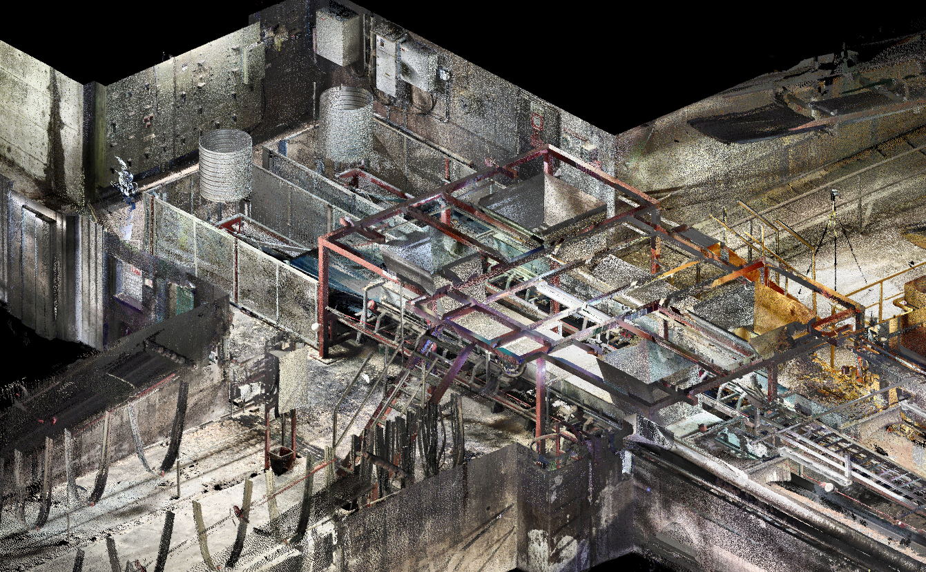
Frontier Metrology specializes in high-accuracy LiDAR scanning and Photorealism services for industrial facilities, infrastructure, construction projects, manufacturing environments, and complex assets worldwide. Using advanced terrestrial LiDAR technology and industry-leading software, our experienced team captures millions of precise measurement points to create detailed, georeferenced point clouds that provide a complete digital representation of real-world conditions.
Our field teams are experienced in scan registration, control network setup, and delivering processed data in the formats your project requires — whether that's a registered point cloud, a BIM model, or a 2D drawing set.
We work across Canada and adapt our workflow to your project schedule, site access requirements, and deliverable specifications.
Industries Served
- Infrastructure
- AEC
- Industrial
- Power Generation
- Mining
Equipment & Technology
- FARO Focus 350s
- LiDAR Spheres
- Survey Monuments
Deliverables
What You Receive
Registered Point Clouds
We can provide Colourized Point Clouds, fully registered, georeferenced point cloud data delivered in RCP, E57, LAS, or PTX format for use in your preferred software.
BIM & Revit Models
As-built BIM models developed from scan data in Revit, suitable for renovation, retrofit, and facility management workflows. Available in all levels of detail (LOD).
2D Drawings & Plans
Floor plans, elevations, sections, and detail drawings extracted from point cloud data to your required scale and standard.
As-Built Inspection
Comparison of as-built conditions against design intent, identifying clashes, deviations, and out-of-tolerance conditions.
Photorealistic Models
Using our proprietary workflows we provide customers with Photorealistic models for use in engineering, Film & Television, and VFX applications.
Volumetric Calculations
Calculate volumes of material piles for logistics, planning, and resource management.
Common Applications
How Our Clients Use This Service
As-Built Documentation
Capture accurate as-built conditions of facilities, structures, and infrastructure for record, renovation, and retrofit.
Scan-to-BIM
Convert point cloud data into Revit BIM models for use in design, construction, and facility management.
Plant & Facility Scanning
Document industrial plants, process facilities, and manufacturing environments for engineering and maintenance.
Infrastructure Inspection
Inspect bridges, tunnels, roads, and civil structures for deformation, settlement, and condition assessment.
Heritage Documentation
Create accurate digital records of heritage buildings, monuments, and cultural sites for preservation and restoration.
Construction Verification
Compare as-built construction progress against design models to identify deviations before they become costly.
FAQ
Frequently Asked Questions
Get Started
Request a LiDAR Scanning Quote
Tell us about your project. Our metrology specialists will review your requirements and respond within one business day with a detailed proposal.
Explore More
Related Services
Your Cart
Your cart is empty.