
Drone Services
High-resolution aerial imagery, video, photogrammetry and inspection services for industrial, construction, infrastructure, and engineering projects.
Overview
Drone Inspection Capabilites
Frontier Metrology provides professional drone services for aerial imagery, video capture, photogrammetry, and visual inspection applications. Our drone services provide a safe and efficient way to capture large-scale site information, monitor project progress, inspect hard-to-reach assets, and document existing conditions.
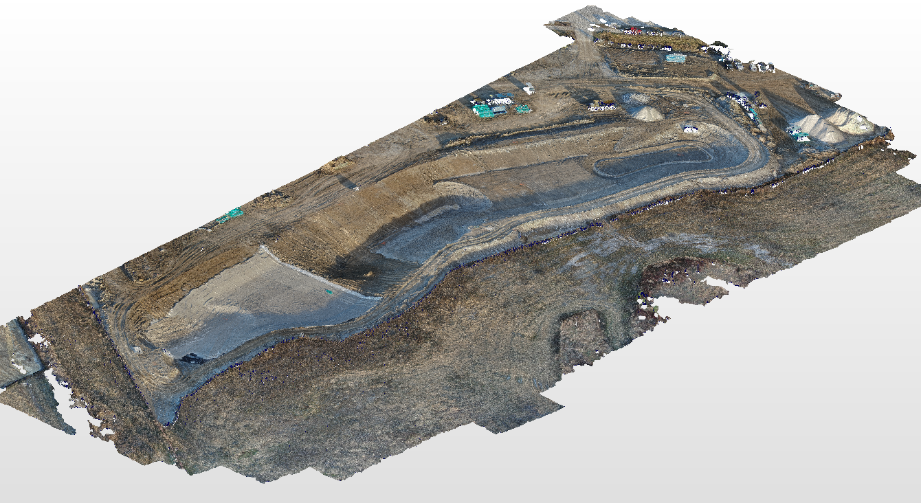
Using high-resolution imagery and photogrammetric processing, we generate accurate visual records, 3D site models, and project documentation that support engineering, construction, infrastructure, and industrial projects.
Industries Served
- Infrastructure
- AEC
- Mining
- Power Generation
- Industrial
Equipment & Technology
- Drones
- Photogrammetry Software
- Survey Drone Targets
Deliverables
What You Receive
High Resolution Imagery
Georeferenced aerial photographs captured at high resolution, providing detailed visual records of sites, structures, and assets for documentation, reporting, and analysis.
High Resolution Video
Smooth, stabilized aerial video footage of sites and facilities, suitable for progress documentation, client reporting, stakeholder presentations, and marketing.
Photogrammetry Models
Accurate 3D models and orthomosaic maps generated from overlapping aerial imagery, providing measurable spatial data for engineering, construction, and infrastructure applications.
Visual Inspections
Close-range aerial inspection of structures, rooftops, towers, bridges, and other hard-to-reach assets, reducing the need for scaffolding, rope access, or equipment shutdowns.
Project Monitoring
Scheduled aerial surveys that track construction progress, earthwork volumes, and site development over the course of a project, keeping stakeholders informed at every stage.
Change Over Time
Comparative analysis of repeat aerial surveys to document site changes, measure earthwork movement, track asset condition, and support long-term project records.
Common Applications
How Our Clients Use This Service
Construction Progress Monitoring
Regular aerial surveys to track construction progress, earthworks, and site development.
Infrastructure Inspection
Safe inspection of bridges, towers, transmission lines, and other infrastructure from the air.
Volumetric Analysis
Stockpile volume calculations and cut/fill analysis for mining, quarrying, and earthworks.
Site Mapping & Surveying
Large-area topographic mapping and site surveys for engineering and planning.
Thermal Inspection
Thermal imaging surveys for building envelope, solar panel, and electrical infrastructure inspection.
Asset Documentation
Aerial documentation of facilities, assets, and sites for record, insurance, and maintenance.
FAQ
Frequently Asked Questions
Get Started
Request a Drone Services Quote
Tell us about your project. Our metrology specialists will review your requirements and respond within one business day with a detailed proposal.
Explore More
Related Services
Your Cart
Your cart is empty.