Industries Served
Metrology for Infrastructure Projects
Precise 3D scanning and measurement for bridges, tunnels, transit systems, and civil infrastructure across Canada.
Overview
Metrology Built for Infrastructure
Infrastructure projects demand accurate as-built documentation and dimensional verification at scale. Frontier Metrology provides LiDAR scanning, 3D scanning, and laser tracking services for bridges, tunnels, transit systems, and civil infrastructure — delivering the data engineers need to plan, build, and maintain Canada's critical assets.
The Challenge
Infrastructure assets are large, complex, and often difficult to access. Capturing accurate as-built conditions requires measurement technology that can handle long ranges, challenging environments, and tight project schedules.
Our Solution
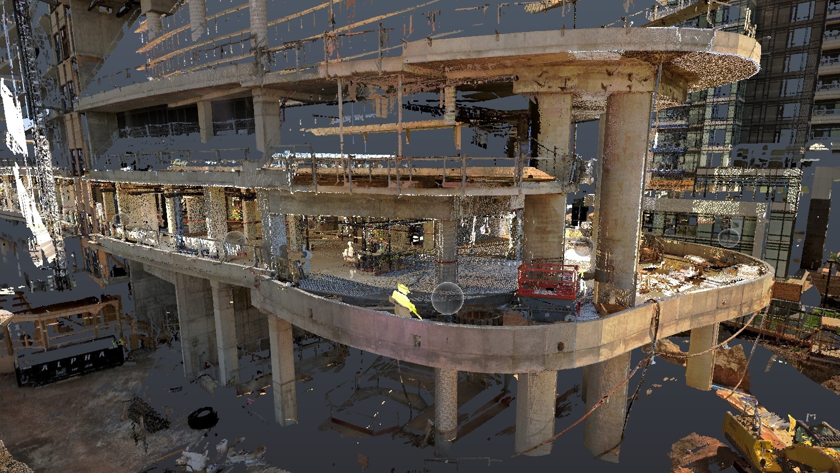
Our FARO long-range LiDAR scanners capture complete infrastructure geometry with millimetre accuracy. We deliver point cloud data, 3D models, and dimensional reports that support engineering analysis, renovation planning, and regulatory documentation.
Applications
Common Applications in Infrastructure
Where our measurement services make the biggest difference for Infrastructure teams.
Bridge Inspection & Measurement
Full 3D capture of bridge structures for condition assessment, load analysis, and renovation planning.
Tunnel Scanning
Complete point-cloud documentation of tunnels for as-built records, deformation monitoring, and clearance verification.
Transit System Documentation
As-built scanning of rail corridors, stations, and transit infrastructure for design and maintenance.
Structural Deformation Monitoring
Repeat scanning to detect and quantify structural movement, settlement, and deformation over time.
Clash Detection Support
Accurate as-built models for clash detection in renovation and expansion projects.
BIM Integration
Scan-to-BIM deliverables compatible with Revit, AutoCAD, and other engineering platforms.
Results
What Infrastructure Clients Gain
The measurable impact of working with Frontier Metrology.
Complete Site Capture
Long-range LiDAR captures entire infrastructure assets in one visit, eliminating costly return trips to site.
Faster Engineering Decisions
Revit and AutoCAD-compatible deliverables give your engineering team data they can use immediately.
Confidence in Every Dimension
Millimetre-accurate as-built data eliminates the guesswork that leads to costly errors in renovation and expansion projects.
Services
Relevant Measurement Services
Ready to Discuss Your Infrastructure Project?
Our team is ready to help. Contact us for a no-obligation consultation and quote.